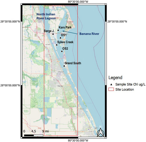
Research funded by The Herbert W. Hoover Foundation and published in GeoHealth demonstrates an improved satellite-based method for monitoring harmful algal blooms and changing water conditions in Florida’s Indian River Lagoon. By combining three years of Sentinel satellite imagery with field measurements, researchers were able to distinguish and map cyanobacteria, dinoflagellates, seagrass, and other water components at a resolution of 10 meters. The approach could provide environmental managers with a powerful tool to track blooms over time, better understand their potential causes, and identify threats to critical habitats like seagrass.
We use cookies to enhance your experience while using our website. If you are using our Services via a browser you can restrict, block or remove cookies through your web browser settings. We also use content and scripts from third parties that may use tracking technologies. You can selectively provide your consent below to allow such third party embeds. For complete information about the cookies we use, data we collect and how we process them, please check our Privacy Policy